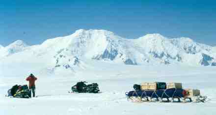
Omega Livingston Island GPS Expedition 2003 Photos Press Coverage Dispatches Introduction There are presently two permanent scientific stations on Livingston – the Spanish base King Juan Carlos I and the Bulgarian base Kliment Ohridski. These are occupied only throughout the summer, in addition to field camps of other national Antarctic programs elsewhere on the island, particularly the Cape Shirreff and Byers Peninsula areas. These latter areas support significant wildlife habitats and are thus designated as Antarctic Specially Protected Areas (SPAs), zones where human activity is strictly controlled. The Omega team will not be operating in these areas nor in areas close by. A New Map of Livingston In addition, the height of Mt. Friesland is quoted at a variety of figures and the name and height of the second-highest peak is also uncertain. The Omega team will endeavour to climb as many of the peaks of the range as possible, height the summits using GPS and attempt to resolve any outstanding issues of both height and nomenclature. This new information will be combined with data from both the BAS maps and work by the Spanish, to produce a new, more accurate map of Livingston Island. This map will be in both digital and paper format and made available to all later in 2004. The Omega team have already received excellent support and input from the University of Barcelona and the Cartographic Institute of Catalonia in Spain, the British Antarctic Survey (BAS) and Geosciences Australia. Omega hopes to be able to both complement and build upon their excellent work over many years, in doing so making another significant contribution to humanity’s understanding of the Antarctic continent. The Omega Expedition The Omega Foundation has run several expeditions to Antarctica in recent years and first attempted to measure Mt. Shinn in December 2001. That attempt was thwarted due to avalanche danger high on the mountain, but it provided the knowledge and experience to make the 2002 expedition so successful. Conditions this season on Livingston Island will make scientific fieldwork in the mountains extremely challenging and the team know that there is a chance that all their objectives may not be met this season. This is the norm for scientific work in Antarctica, but the Foundation’s long-term commitment to Antarctic science ensures that further work can be undertaken in following seasons if necessary. The Plan After establishing a safe base camp, the first priority will be the ascent and measurement of Mt. Friesland. The team will once again use the Iridium satellite phone network to submit their raw GPS data, collected on their Trimble 5700 GPS receiver, to the AUSPOS site run by Geosciences Australia. This provides post-processing of data that will enable the Omega team to know the exact height of Friesland, if the job went well, while they are still in the field. Once this first phase is completed the team can then go on to measure the other high peaks of the range. All activity on Livingston, including the helicopter flights, will be extremely weather-dependent as the island receives some of the worst weather in the world. The team plan to be on the island for four weeks, but may only see five or six truly clear days in that time. Team Biographies Rodrigo Fica In late 1999 Rodrigo and some Chilean friends spent 99 days making the first complete north-south crossing of the Southern Patagonian Icecap. This great achievement was just one factor leading to his joining the Omega Foundation last year to climb and measure Mt. Shinn. Though originally a computer engineer, Rodrigo now works as a mountain guide in South America and has had his articles and photographs published around the world. Most recently Rodrigo summited Mt. McKinley (6194m) in Alaska with his wife Patti, a former Everest summiteer. John Bath The Expedition’s GIS specialist, John has experience conducting mapping operations in remote parts of Australia and the South Pacific and in training others in GPS and remote sensing systems. He is now the Program Co-Ordinator for a major outdoor recreation course. He regularly guides backcountry ski trips in the Australian Alps and teaches other outdoor programs from his base in northern Victoria. He has trekked and climbed in Patagonia and Nepal. This will be John’s first expedition to Antarctica. Osvaldo Usaj Osvaldo, at 19, is the youngest member of the Expedition. A student in Political Science at Arcis University in Punta Arenas, he has also undertaken his military service, during which he learned survival techniques, GPS navigation and other outdoor skills that will be useful on Livingston Island. In addition to hunting and trekking, Osvaldo plays rugby and briefly studied English at St. Clare’s College, Oxford. With his strong language skills, outgoing nature and broad education, The Omega Foundation hopes that Osvaldo’s participation in the Expedition will raise awareness of Antarctic issues in Chile and beyond. Follow this link for more information about Osvaldo and the selection process.
Thanks to Damien Gildea for this expedition overview! |
|
Home Links |