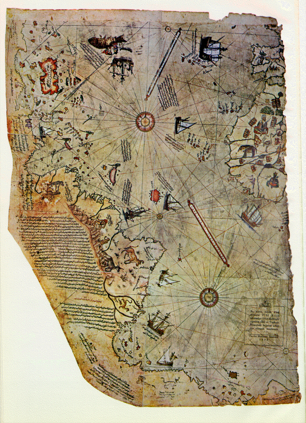
Click on the above map for a very large JPG (3.31 MGB) image.
The Piri Reis Map of 1513 is the first surviving map that shows the Americas (the Vinland map
may be older but only shows a part of North America). The Piri Reis map shows North America,
South America, Greenland and Antarctica which had not yet been discovered. The map was
made by a Turkish Admiral Piri Ibn Haji Mehmed. Reis means admiral. Piri Reis did not long
bath in the light of this famous work but was beheaded in 1554 for an unsuccessful foray into
the Persian Gulf. The map became lost and was only rediscovered in 1929 by a group of
historians working in the harem section of the Topkapi Palace in Istanbul (Constatinople) found
the map in a pile of rubble.
Because of the details on this map, many claims have been made for this map. Some even believe
that it is so perfect that it could only have been made from very high altitude photographs. Some
of this claims can be found at the following web sites:
The Piri Reis map is not made like modern maps with horizontal and vertical grid for location purposes but with an older method perfected by Dulcert Portolano which instead had a series of circles with lines radiating from them. Maps made by this method are thus termed "portolan" maps. Their purpose was to guide navigators from port to port and not for the modern idea of find position. This makes it more difficult to compare features from the Piri Reis map with modern maps.
The Piri Reis map also has a number of notes written on the map. These notes cover everything
from Columbus discovering the New World to sea monsters. A translation of these notes is
supplied.