|
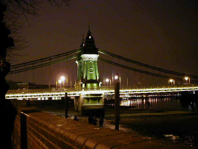
This site chronicles the trials and tribulations of the bridge since 1999. It's main purpose was to keep everyone involved informed whilst the 2 year closure was in place. It is now an historical record of those times. The last years have been a chequered time in the history of Hammersmith Bridge. It's been closed, repaired, opened, bombed, closed, re-repaired and re-opened. Hopefully it will now be open for good. The traffic is flowing over the bridge (the A4 permitting). Those of you who have driven over the bridge at night will have noticed that the bridge is lit up and looks stunning. If you haven't seen the bridge at night have a look at the pictures for a taster. A drink in one of the pubs along the newly repaved River Walk on a fine summer evening is now enhanced with the magnificent night time views of the bridge. |
|
 Click here for
Pictures Click here for
Pictures |
|
| What
was the effect of the original closure? How was the decision to re-open
the bridge taken? What has happened to the traffic flows since it
re-opened? Click here for a fuller report of the reasons for the closure. |
Hammersmith & Fulham's Highways Division are responsible for Hammersmith Bridge. For more information follow this Link. |
|
For information follow these links! Technical Report with information into the reasons for the closure This is a long document and may take some time to load Traffic Survey Information (no longer updated) |
Send comment by e-mail or post to Highways (Hammersmith Bridge) LB Hammersmith & Fulham 4th Floor Town Hall Ext King Street Hammersmith W6 9JU |
-
The mapping on this site has been extracted from Ordnance Survey material. Ordnance Survey maps, and maps created from Ordnance Survey material are subject to Crown copyright. The use of the mapping is limited to an allowance to view and download it onto your system for private and non-commercial purposes only. The mapping may not be further sub-licensed, sold, demonstrated, lent, or otherwise transferred or exploited without the prior written permission of Ordnance Survey. Ordnance Survey shall not be held liable for the Map Material not being fit for your purposes or applications.
- Further details about Ordnance Survey products and services can be found on the Internet , URL http://www.ordsvy.gov.uk