Introduction
|
|

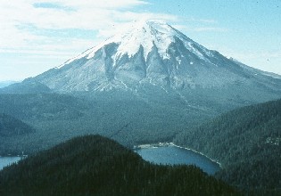
Mount St. Helens' sunset before 1980. The peak's symmetric cone earned it the
title of the "Fuji of North America." USFS photo courtesy of Jim Hughes.
|
During the years prior to 1980 Mount St. Helens and the Spirit Lake Basin provided
a recreational haven. The US Forest Service estimated that over half a million
people visited the Spirit Lake area in 1979.
The heaviest visitation was during the summer months, when most came to camp,
hike and fish. Camps belonging to the Boy Scouts, Girl Scouts and YMCA were located
along the northeast arm of Spirit Lake. Other private lodges and cabins dotted
the lakeshore and along State Route 504 for several miles to the west.
Few of these thousands of visitors realized that this recreational paradise
contained an active volcano.
Mount St. Helens began to show the first signs of volcanic unrest in March
of 1980. Earthquakes, ground deformation, and steam explosions would continue
for nearly two months before culminating in a major eruption on May 18. The purpose
of this portion of our website is to provide a summary of the events that led
to this eruption.
|
Weekly Summaries
|
|
|
The following summary
of events is provided as a courtesy by the U.S.
Geological Survey, Cascades Volcano Observatory, Vancouver, Washington. We
duplicated the information here to assist teachers, educators and students in
developing their educational programs as part of the Mount St. Helens National
Volcanic Monument Teacher's Corner.
If you use any of the material on these pages, please credit the U.S.
Geological Survey, Cascades Volcano Observatory, Vancouver, Washington. We
sincerely thank them for their support of the Teacher's Corner.
|
| Conditions For Use Of Photographic
Images - Most of the photographs contained in this collection are publicly
owned and are available for unrestricted use. We ask you respect the efforts of
the individual photographers and clearly label any published photos with the photographer
name and agency or institutional byline. Individual photographers also donated
photographs for use in this collection. These photos are labeled with an individual
person's name only (there is no institutional affiliation). Reproduction of images
from these private individuals is not permitted without the express permission
of the individual photographer. |
Beginnings
|
|
Mount St. Helens before the 1980 eruption.
|
Although historical accounts of eruptions during the 1800's suggested the possibility
of renewed volcanic activity at Mount St. Helens, the foundation of scientific
information that allowed realistic evaluation of the hazards was laid over several
decades.
Because the mountain has long been a favorite of climbers and naturalists,
two areas of fumaroles and warm ground had been documented as early as 1939. The
first systematic geologic investigation was a reconnaissance study begun in the
1930's by Verhoogen. According to his report published in 1937, "activity
of the volcano seems to have continued without interruption until very recent
times. Many [lava] flows cannot be more than a few hundred years old, as evidenced
by the vegetation."
Later geologic studies verified the relative youth of volcanic deposits from
Mount St. Helens. The geologic record of past eruptions was sufficiently well
documented by 1975 to enable USGS geologists Dwight Crandell and Donal Mullineaux,
and geochemist Meyer Rubin to warn, in an article in Science magazine, that "...an
eruption is likely within the next hundred years, possibly before the end of this
century."
|
|
|
Crandell and Mullineaux produced a more comprehensive assessment of the volcanic
hazards at Mount St. Helens in 1978 as part of a broad USGS program for the systematic
evaluation of volcanic hazards in the Cascades.
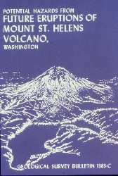
The results were published as USGS Bulletin 1383-C (shown at left). It summarized
the mountain's eruptive history over the past 4,500 years and showed hazard zones
for various types of future ashfalls, lava flows, pyroclastic flows, mudflows
and floods. The report also described Mount St. Helens as "more active and
more explosive during the last 4,500 years than any other volcano in the conterminous
United States."
This report and a letter discussing its implications were sent to appropriate
Federal, State, and selected county and local agencies in southwestern Washington.
In January 1979 USGS scientists met with key Federal and State officials to explain
the implications of the report.
|
|
|
While the assessment of volcanic hazards was being prepared, the volcano was
already being monitored to detect early signs of an impending eruption. No one
knew what types of monitoring techniques would prove most reliable, however, because
knowledge about the behavior of Cascade volcanoes in general was limited and because
Mount St. Helens had not been active recently.
University and USGS studies in the 1970's had monitored the volcano intermittently
using three approaches: (1) seismometers that could detect earthquakes caused
by the movement of molten rock, (2) precise ground-surface measurements that could
detect swelling of the volcano, and (3) aerial infrared surveys and surface temperature
measurements of the two "hot spots" high on the mountain to detect any
changes in heat emission.
The volcano was also photographed routinely from the air to detect changes
in snow and ice as part of a USGS glaciology research project.
At the beginning of March 1980 the only instrument directly monitoring Mount
St. Helens was a seismometer on the western flank of the volcano. This station
(SHW) automatically transmitted earthquake data by radio (telemetered) to seismic
recorders at the University of Washington in Seattle. Station SHW was one of about
one hundred seismometers deployed in a network throughout western and central
Washington by the University's Geophysics Program in cooperation with the USGS.
|
|

Map of Mount St. Helens area and the Spirit Lake basin prior to the 1980 eruption.
Key landmarks are noted and referred to in later sections of the site.
|
References
|
- Crandell and Mullineaux, 1978. USGS Bulletin 1383-c, Potential Hazards from
Future Eruptions of Mount St. Helens Volcano, Washington.
- Foxworthy and Hill, 1982. USGS Profesional Paper 1249, Volcanic Eruptions
of 1980 at Mount St. Helens: The First 100 Days.
- Lipman and Mullineaux (editors), 1982, USGS Professional Paper 1250, The 1980
Eruptions of Mount St. Helens, Washington.
- Various staff writers, March 20 through May 18, 1980, Excerpted articles from
the Longview Daily News.
- Various staff writers, March 20 through May 18, 1980, Excerpted articles from
the Oregonian.
- Various staff writers, March 20 through May 18, 1980, Excerpted articles from
the Vancouver Columbian.
|
Conditions For Use Of Photographic Images
|
|
Most of the photographs contained in this collection are publicly owned and
are available for unrestricted use. We ask you respect the efforts of the individual
photographers and clearly label any published photos with the photographer name
and agency or institutional byline.
Individual photographers also donated photographs for use in this collection.
These photos are labeled with an individual person's name only (there is no institutional
affiliation). Reproduction of images from these private individuals is not permitted
without the express permission of the individual photographer.
|
|
|
|
|
|