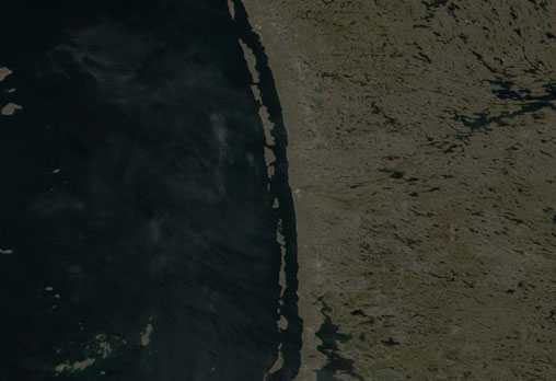
Nastapoka Islands

- MODIS image
- date unknown
The eastern coast of Hudson Bay is marked by an extensive semi-circular embayment — without name — that measures some 475 km across (straight-line distance), from Pointe Louis XIV in the south to Cape Dufferin in the north, indenting the coast by up to 180 km. Much of the coastline in this region is lined by several groups of narrow, elongate islands that form a coastal barrier, behind which lies a relatively sheltered channel. The major island groups include the Hopewell Islands, the Nastapoka Islands and the Long Islands. In all, the Hopewell-Nastapoka-Long Island chain extends for around 600 km along the coast of the southeastern corner of Hudson Bay.
The Nastapoka Islands extend southwards along the central coast of James Bay for a distance of 165 km. Their northernmost member (a small islet located off the coast of McTavish Island) is located 4.7 km southwest from Pointe Niaqurnaq and 17.4 km southeast from Cotter Island. Flint Island, the southernmost island, is located 7 km northwest from Pointe Qilalugarsiuvik. Like the Hopewell and Long Islands many of the islands are cuesta formations with steep-faced ridges facing the mainland that then descend via low gradient slopes to their western coasts. As is the case with all islands found within Hudson Bay, James Bay and Ungava Bay, the Nastapoka Islands form part of the territory of Nunavut.
The largest islands of the chain are found in the centre and north and include: Gillies Island (19.4 km x 2 km), Davieau Island (15 km x 4.6 km) and Broughton Island (17.5 km x 3.5 km). Significant others include: McTavish Island, Nicholson Island, Christie Island, Mowat Island, Gordon Island, Miller Island, Taylor Island, Curran Island, Armstrong Island, Clarke Island, Luttit Island, Anderson Island, Ross Island and Belanger Island.
image: MODIS rapid response project at nasa/goddard space flight center
Location Map

