
Elato
- Landsat 7
- Path 099 Row 055
- 25 April 2001
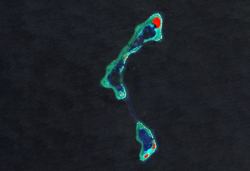
Elato — shown here in false-colour, with vegetation cover in red — is a small atoll of the western Caroline Islands, located within the southeastern sector of Yap State. The atoll lies 9 km west from Lamotrek and 36 km southeast from Olimarao; the state capital of Colonia, on Yap, lies some 900 km to the northwest.
Elato, at 11 km² in area, is the northern component of a double atoll formation. The southern component, known as Lamolior is connected to Elato via a narrow submarine ridge — both formations are the emergent parts of the same seamount. The emergent parts of the structure measure around 14 km in length and 2 km across. Lamolior contains two small islets, and Elato contains two lagoon basins and three islets. Their combined land area is in the region of 0.5 km².
image: millenium coral reefs landsat archive/usf millenium global coral reef mapping project/nasa seawifs/nasa jsc