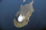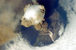
Matua
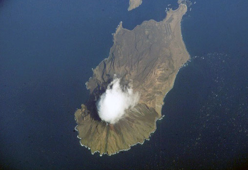
- ISS005-E-17795
- October 2002
- 02:01 UTC
The 52 km² island of Matua (Остров Матуа) lies within the Central Group of islands, located 30 km northeast of, and across the Nadezha Strait from, Rasshua.
Unusually, its greatest extent extends northwest to southeast instead of lying along the northeast to southwest axis of the Kuril chain. The smaller island of Raykoke is situated 18 km to the northeast across the Golovnina Strait. Off the southeastern end of Matua lie a number of smaller islands and islets, the largest of these being Toporkovyy (visible at he the top-centre of the image).
The northwestern end of the island is dominated by the active volcano of Sarychev, that is topped by an impressive crater wall that contains the islands highest point of 1,496 m. The coasts on the northwest slopes of the volcano consist of recent lava flows that have given the coastline in this area its jagged appearance. On the northeastern side the volcano slopes down to the lowlands that occupy the extreme northeastern ends of the island.
image: earth sciences and image analysis laboratory, nasa johnson space center
Location Map