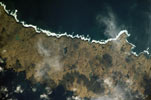
Amchitka
- ISS005-E-18292
- 23 October 2002
- 00:44 UTC
The highly elongate island of Amchitka (300 km²) is located on the southern edge of the Rat Islands group, situated 53 km southwest from Semisopochnoi and 28 km southeast from Little Sitkin; to the west, the Amchitka Pass separates the Rat Islands from the islands of the Delarof group. The closest significant neighbour to Amchitka is Rat Island, located 21 km to the northwest across the Oglala Pass.
Extremely narrow relative to its width, Amchitka measures 65 km in length (orientated northwest to southeast) — from East Cape in the east to Aleut Point in the west — and averaging around 5-6 km across. Terrain on the island exhibits a progression from east to west: the landscape of the east consists of a low-lying plateau that is studded with numerous small lakes. The topography of the western end of the island can be split into two zones: a rugged, lake-free upland plateau (with an average elevation of 240 m above sea level) in the west and an eastern mountainous region that reaches a maximum elevation above sea level of 343 m.
image: earth sciences and image analysis laboratory, nasa johnson space center
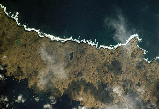
Location Map