
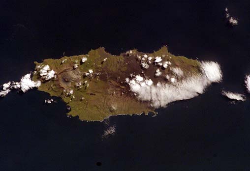
Seguam
- ISS011-E-13559
- 24 September 2005
- 23:16 UTC
Easternmost of the Andreanof Islands, the 215 km² island of Seguam is located 28 km northeast from the eastern tip of Amlia and 68 km southwest from Amukta.
Seguam is an approximately oval-shaped, mountainous island measuring 24 km in length and that is up to 11 km in width. The island has two large caldera structures: on the east is the horseshoe-shaped, collapsed remains of the Wilcox Volcano The western caldera, measuring up to 4 km across, contains a central scoria cone known as Pyre Peak that rises to a height of 1,054 m. The eastern tip of the island is occupied by the small Moundhill Volcano.
image: earth sciences and image analysis laboratory, nasa johnson space center
Location Map